Further routes along the Zugspitz-8
For cyclists in good condition, the Zugspitz-8 can be extended with various demanding additional bike routes.
Start: Ehrwald, valley station Ehrwalder Almbahn-cable car | Garmisch-Partenkirchen, Railway Station | Grainau, Kurhaus
Finish: circular tour
Length: 79,4 km
Time: 7,5 h
Altitude Difference: 2.423 hm
Level of Difficulty: High Alpine Tour (black)
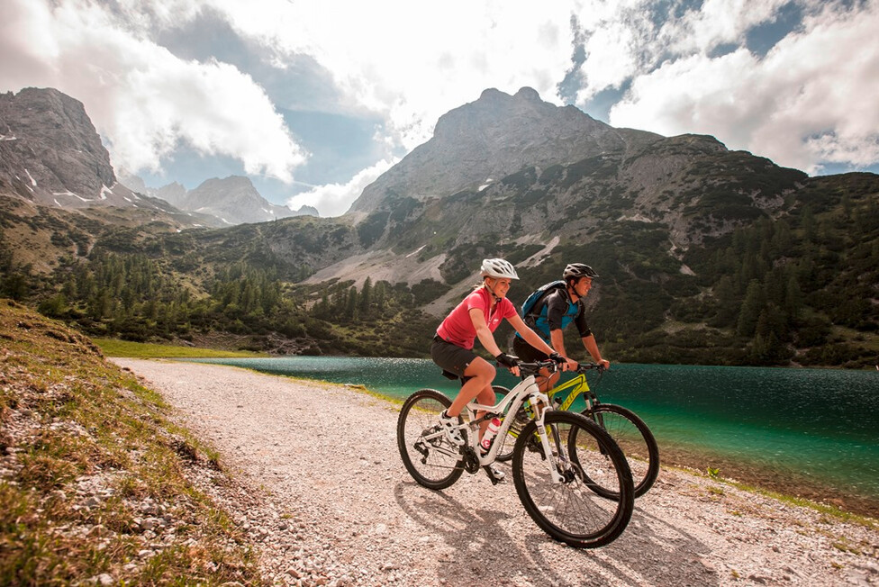
Varied mountain bike tour with fantastic views of the Wetterstein Mountains, the Miemienger Kette and the Karwendel. At Eibsee you can enjoy the wonderful view of the Zugspitze.
Here you get directly to the GPX data download and the tour description.
Start: Garmisch-Partenkirchen, Railway Station
Finish: Ehrwald, center
Length: 22,8 km
Time: 2 h
Altitude Difference: 308 hm
Level of Difficulty: valley path
Easy valley trail, starting from Garmisch-Partenkirchen along the Loisach via Griesen to Ehrwald.
Start: Grainau, Unterer Dorfplatz | Ehrwald, Railway Station, Zugspitzstraße
Finish: Hochthörle Hütte
Length: 20 km / 17, 2km
Time: 3,5 h/ 2,5 h
Altitude Difference: 756 hm / 588 hm
Level of Difficulty: moderately difficult routes
Cross-border round tour at the foot of the Zugspitze and Ehrwalder Becken.
Variation: Um die Thörlen
Start: Garmisch-Partenkirchen, Railway Station
Finish: Plansee/Heiterwanger See
Length: 21,5 km - 28 km
Time: 2,5 h - 3,5 h
Altitude Difference: 340 hm
Level of Difficulty: moderately difficult routes
Cross-border valley path and forest path to the two interconnected lakes, Heiterwanger See and Plansee. Starting from Garmisch-Partenkirchen via Grainau to Griesen. From there along the Neidernach to Plansee and Heiterwanger See.
Start: Ehrwald, Viadukt, Garmischer Straße
Finish: circular tour
Length: 48,3 km
Time: 4 h
Altitude Difference: 864 hm
Level of Difficulty: moderately difficult routes
Beautiful round tour around the striking summit Daniel (Ammergauer Alps), along the two lakes Plansee and Heiterwanger See. As well as through Griesen and the villages of the Tiroler Zugspitz Arena.
Here you get directly to the GPX data download and the tour description.
Start: Berwang, Kirche
Finish: Mitteregg
Length: 7,6 km
Time: 1,25 h
Altitude Difference: 248 hm
Level of Difficulty: valley path
The dreamlike tour through beautiful meadows and gravel paths starts at the church St. Jakob and leads through gullies to Mitteregg.
Here you get directly to the GPX data download and the tour description.
Start: Ehrwald, Talstation Ehrwalder Almbahn
Finish: Seebensee
Length: 8,9 km
Time: 2 h
Altitude Difference: 642 hm
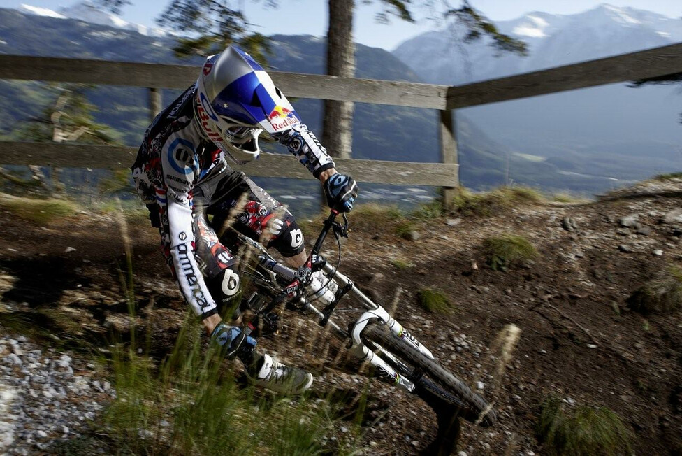
Level of Difficulty: High Alpine Tour (black)
From the valley station on the steep forest path to the Ehrwalder Alm (alternative: use Ehrwalder Albahn) and further over the Seebenalm to idyllic Seebensee. The lake lies in a picturesque mountain landscape with a view of the Wetterstein massif.
Here you get directly to the GPX data download and the tour description.
Start: Bichlbach, Zunftkirche
Finish: circular tour
Length: 13,8 km
Time: 2-3 h
Altitude Difference: 555 hm
Level of Difficulty: moderately difficult routes
Round trip on sporty trails through fantastic mountain scenery. From Bichlbach via the "Berwanger Talweg" to berwang and on to the Heiterwanger Hochalm (1.608m), the highest point of the tour. Over the initially steep downhill path into the light and back to the starting point.
Here you get directly to the GPX data download and the tour description.
Start: Bichlbach, Zunftkirche
Finish: circular tour
Length: 16,6 km
Time: 3 h
Altitude Difference: 768 hm
Level of Difficulty: moderately difficult routes
Demanding round tour into the Raaz alpine pasture area with beautiful panoramic views. From Rinnen via Rotbachwiesen to Ehenbichler Alm and from there to Ehenbichler Alm and from there to Sennalpe Raaz. The descent to the Rotlech reservoir is only recommended for experienced mountain bikers (very steep, difficult route).
Here you get directly to the GPX data download and the tour description.
Start: Biberwier, Hotel Alpina Regina, Fernpass Straße
Finish: circular tour
Length: 8,4 km
Time: 1,25 h
Altitude Difference: 222 hm
Level of Difficulty: valley path
A bike tour for the whole family, past the lakes, Mittersee and Weißensee and the Loisach springs.
Start: Biberwier, Forstweg unterhalb Bergstation (bei 1.480 hm), Auffahrt mit Marienbergbahn
Finish: Mittelstation Marienbergbahn
Length: 2,2 km
Time: 20 min
Altitude Difference: 428 hm
Level of Difficulty: S2, S3
Technically demanding trail (S2 to S3) through dense woodland, which runs smoothly from the 2nd section (S1). Continuing single trail in the connection "Rauhe Gasse" (S1) to the hotel MyTirol.
Here you get directly to the GPX data download and the tour description.
Start: Lermoos, Grubigalm | Auffahrt mit Grubigbahn 1+2
Finish: Bretllalm
Length: 3,2 km
Time: 20 min
Altitude Difference: 381 hm
Level of Difficulty: S2
Singletrail with many pumptrack elements, steep curves and technically demanding top sweeps (S2). Forest one can be driven directly afterwards.
Here you get directly to the GPX data download and the tour description.
Start: Lermoos Brettlalm (Gschwandkreuz), Auffahrt mit Grubigbahn 1
Finish: Lermoos
Length: 2,8 km
Time: 15 min
Altitude Difference: 384 hm
Level of Difficulty: S3
Singletrail for MTB freaks. Varied, exciting trail through the mountain forest.
Here you get directly to the GPX data download and the tour description.
Start: Lermoos, Grubigalm | Auffahrt mit Grubigbahn 1+2
Finish: Blindsee
Length: 7,1 km
Time: 45 min
Altitude Difference: 650 hm
Level of Difficulty: S3
The single trail from Grubigstein to Blindsee combines all the ingredients needed for a guided single trail descent. A mostly flowing trail course, now and then a crisp key point, a gravely section and a wonderful view of the turquoise-blue Blindsee.
Blindseetrail Youtube: Abwechslung in alpinem Gelände
Here you get directly to the GPX data download and the tour description.
Start: Lermoos, Ortszentrum
Finish: circular tour
Length: 16,8 km
Time: 4,5 h
Altitude Difference: 782 hm
Level of Difficulty: High Alpine Tour (black)
Panoramic round tour along the forest path to the idyllic Tuft Alm. Down the forest path to Ehrwald and through the moss back to Lermoos.
Here you get directly to the GPX data download and the tour description.
Start: Heiterwang
Finish: Ehrwald
Length: 18,5 km
Time: 2,5 h
Altitude Difference: 200 hm
Level of Difficulty: moderately difficult routes
Panoramic up and down path over the Panoramaweg towards Ehrwald. The varied path leads past the villages of Bichlbach, Wengle and Lähn to Lermoos. It continues through the moss to Ehrwald.
Here you get directly to the GPX data download and the tour description.
Start: Heiterwang, Parkplatz am Karlift
Finish: circular tour
Length: 28 km
Time: 3,5 h
Altitude Difference: 597 hm
Level of Difficulty: moderately difficult routes
Starting from Heiterwang, via Bichlbach and Berwang to Rinnen. From there over the Rotlech reservoir to Rieden and further over the Klausen forest back to the starting point.
Here you get directly to the GPX data download and the tour description.
Start: Grainau, Kurhaus
Finish: circular tour
Length: 18 km
Time: 2,5 h
Altitude Difference: 520 hm
Level of Difficulty: moderately difficult routes
Over the Neuneralm and the Panoramaweg through the idyllic larch forest and the Eibsee, with a magnificent view of the Eibsee islands.
Start: Garmisch-Partenkirchen, Railway Station
Finish: circular tour
Length: 30,8 km
Time: 4 h
Altitude Difference: 1.183 hm
Level of Difficulty: moderately difficult routes
Beautiful, varied round tour, which begins with a steep ascent to the Esterbergalm. From there, a flat forest path leads directly through the heart of the Esterberg mountains. Then a beautiful single trail leads to the Gschwandtnerbauer and along the foot of the Wanks back to the starting point.
Start: Garmisch-Partenkirchen, Railway Station
Finish: circular tour
Length: 20,6 km
Time: 3,5 h
Altitude Difference: 580 hm
Level of Difficulty: moderately difficult routes
Steep ascents and challenging trails along the Patnach with magnificent views. Starting from Garmisch-Partenkirchen through the Reintal valley to the imposing Bockhütte.
Start: Grainau, Kurhaus | Garmisch-Parenkirchen, Railway Station
Finish: circular tour
Length: 16,7 km
Time: 1 h
Altitude Difference: 180 hm
Level of Difficulty: valley path
Simple and scenically beautiful tour over flat meadows and low-traffic roads, which is particularly suitable for families with small children or as a short training session.
Start: Garmisch-Partenkirchen, Olympia Skistadion
Finish: circular tour
Length: 33,6 km
Time: 3,5 h
Altitude Difference: 960 hm
Level of Difficulty: High Alpine Tour (black)
A challenging tour from the Olympic Ski Stadium in Garmisch-Partenkirchen via the Aule Alm to the Bockhütte. From there via the Partnachalm back to the starting point at the ski stadium.
Start: Grainau, Kurhaus | Garmisch-Partenkirchen, Railway Station
Finish: circular tour
Length: 36 km
Time: 5 h
Altitude Difference: 1.269 hm
Level of Difficulty: High Alpine Tour (black)
Technically demanding round tour over long steep gravel paths and sunny meadows.


